Wednesday, December 02, 2009

Travels and Back In the States

TitiKaveka, Rarotonga, Cook IslandsAlright, I'm long overdue for a post here. I thought I'd post something when I was all employed and settled in, but that's looking like it's going to take a bit longer than I'd originally thought. I'd been keeping up with posts in Flickr and Facebook, but nothing here. So here goes, more of a photo-dump than anything, I think I've also been put off by the sheer volume of stuff to write about.

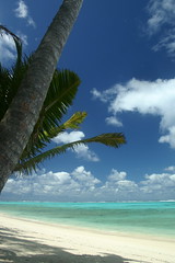
The day after my last day of work Kel, Gayle and I headed to Rarotonga. Claire flew over from London to meet us there a day or two later. There's not a lot to do on the island, but after the stress of wrapping up everything at work, that was fine by me. It was windy and not quite hot enough to make the water as inviting as it looks in the photos, so we did a lot of reading, eating and lounging around. Oh, and thanks to my inattention while grocery shopping we did an unintentional detox while DRINKING DECAF PLUNGER COFFEE ALL WEEK! Gah! I thought it was the water that made it taste funny until Kel noticed the Decaf marking. They should put bright colored warning labels on that stuff and sugar-free crap. :-)

Hermit Crab
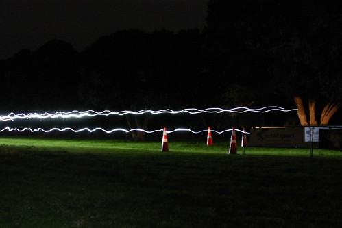
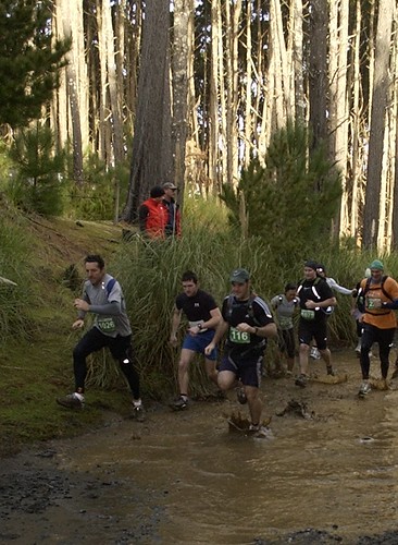
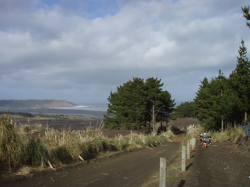
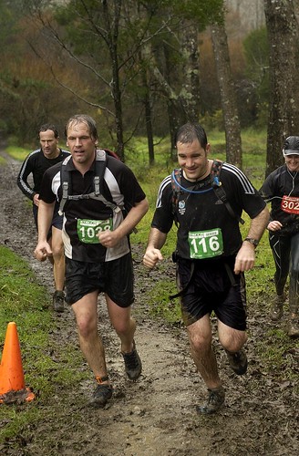
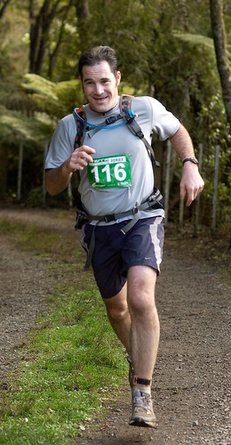
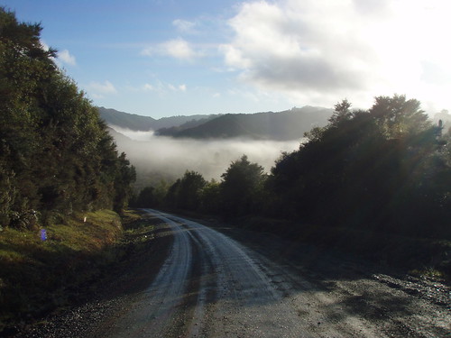
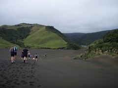
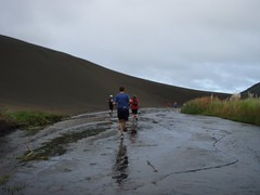
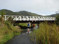
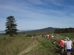
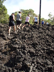
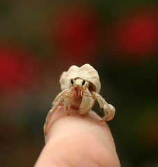
When I got bored, I'd harass the local wildlife or paddle around the lagoon in the house kayak. One morning I went for a run over the highlands in the center of the island on the cross island track. Unfortunately, I'd just missed the annual cross island race which was held the week before we arrived. It was a good 10-15k run, with about half dirt road and half muddy steep jungle track.

Rarotonga Cross Island Track

White Island Steam Vent
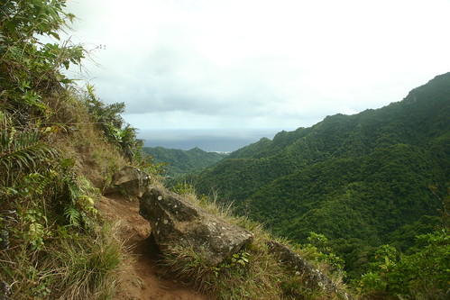
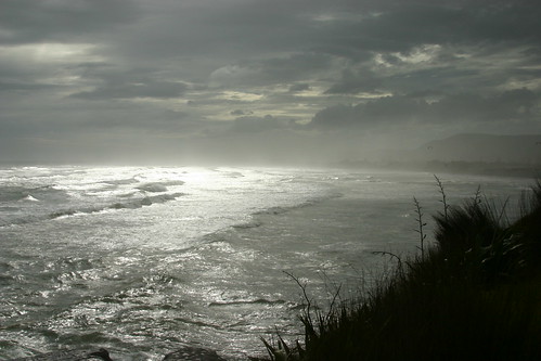
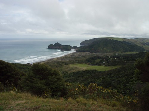
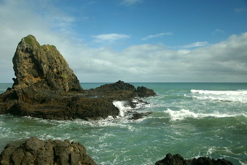
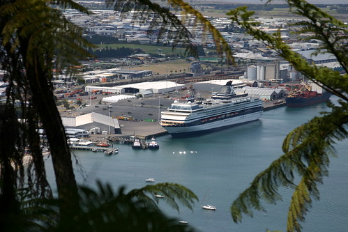
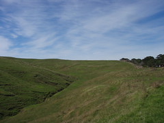
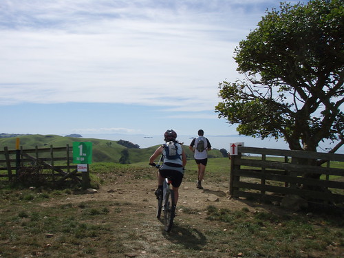
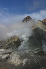
After Rarotonga, we headed over to Whakatane. Kel booked Claire and I on a trip out to White Island, an active volcano about an hour offshore by boat. Despite being seasick the whole way out, that was a great trip. Imagine Yellowstone without all the boardwalks and fences and warning signs. There are just random thermal features that pop up and fade away, and the crater lake changes colours dramatically, depending on what's going on below. When we were there, the water table was quite high due to recent rains, so there was steam everywhere, and new mudpots had recently opened. Our guide also said a second crater appeared to be forming. It had gone from the size of a plate to the size of a house in a matter of weeks. We couldn't go anywhere near that or the sulphur stacks due to the steam.

Mahia
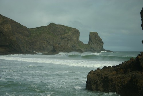
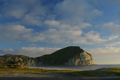
After Whakatane, we drove across through Gisbourne to Mahia on the East Coast, for a second attempt to go swimming with Moko the dolphin. He'd been hanging around Mahia for years, stealing people's beach toys and bringing them fish . . . until the week before we showed up. Now he seems to have moved up the coast to Gisbourne. That's unfortunate for Mahia, as in the off season (when the water's too cold for swimming) there's not a whole lot to do there. Also unfortunate is that it looks like Moko's been having more negative interactions with people in the more populated Gisbourne beaches, knocking surfers off their boards and harassing lifeguards . . . not good. They should maybe try to lure him back to Mahia for his own good.

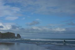
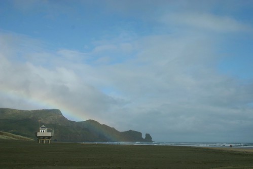
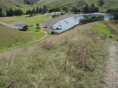
'Friendly' Dolphin Strikes Again - New Zealand Herald.

With the dolphin swim off the agenda, we went to the local pub to drink some beer. We were all excited to see Crayfish (Rock Lobster) dinner on the menu, only to learn that they were out of Crayfish . . . Mahia: the bay of disappointment. Probably best to visit in the summertime. ;-)

Elephant Hill Vines
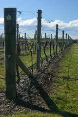
Next we continued along to Napier. Kel had booked us for a Wine Tour with a place called 'Grape Escape'. I should capture the names of the Wineries here before I forget them: Brookfields (excellent Pinot Noir), Ngatarawa/Farmgate, Elephant Hill (where Kel and I had the best gnocchi for lunch), and Matariki.

Claire and Kel at Ngatarawa Winery

One funny thing about our wine tour was the fact that the rest of the tour group were Americans, including two officers on leave from Afghanistan.  I think that's the largest group of Americans I'd seen in NZ since the Te Reo Maori classes we'd taken a year or so before.


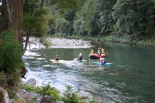
On the way back from Napier, we stayed at The Chateau Tongariro for a couple nights. The intent was to do some skiing, but it was quite late in the season, and the weather wasn't cooperating. But the Chateau is nice whatever the weather. They have an excellent restaurant, and a nice pool/sauna setup in the depths of the building (At least when it's not infested with screaming sproglets. There seemed to be something about the acoustics down there that amplified kid screams to horrific levels). ;-)

From there we had a couple of free days up in Auckland, then Kel and Claire took off for Sydney. I flew over to join them a couple days later.

Surfing Bondi
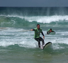
They'd gotten all the shopping out of the way, so we just hit some restaurants (in particular Bill Granger's place) and made a trip over to Bondi Beach. Kel and Claire relaxed in the sun while I went out on a surfing lesson. Those were the best waves I've had in a few attempts at surfing. Makes me wish I'd gotten out at Ohope a few times . . . one of those things you think you'll always have time to do. Then again, as fun as that was, I felt like I'd been hit by a train the next day. ;-)

Claire headed back to London from Sydney (via Hong Kong) while Kel and I flew back to Auckland. The next week was a blur of packing and getting stuff ready to ship, meeting up with friends, and visiting old haunts for the last time. As far as I've heard, my stack of boxes and the kayak Kel gave me for my birthday are still waiting to ship from Albany.

Kel and Gayle saw me off at the Auckland airport with gifts of NZ gear, Pineapple Lumps, and Conchords tunes!

My Brother and his Halloween DisplayOn the other side of the 20 hour trip, I took a cab to my parents place from the Minneapolis Airport after waiting an hour or so for my brother to pick me up. He'd dislocated his shoulder playing volleyball earlier in the evening, and was sitting in the waiting room of the hospital.

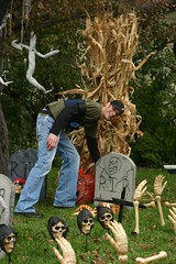
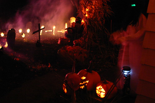
It didn't dampen the Halloween spirit though.

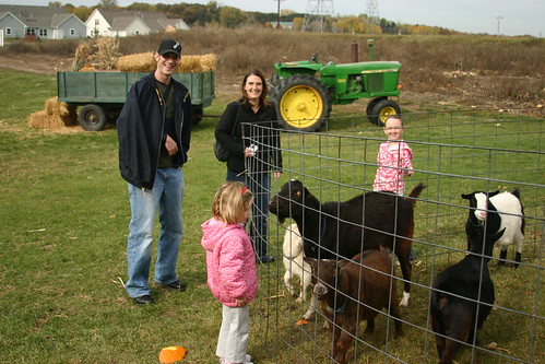
I made it a point to get back to Minnesota in time for Halloween as David always goes all out at his place. We took my nieces to the pumpkin patch the next day. A couple days later we had a pumpkin carving night and horror-movie festival. Halloween night, I handed out candy while David took the girls out trick-or-treating.

David, Mya, Tammy, Trinity

The View from the Candy Door

Since October I've been catching up with friends, and working on finding a job, which is the first part of getting settled back in over here. That seems to be done now, but more on that soon . . .

Wednesday, September 09, 2009

XTerra 6 and a Crazy Few Weeks

August 31st was the last race in the XTerra 2009 Trail Run series. This one was up at Shakespear Regional Park, a nice short drive from Albany. I ended up running with a few coworkers from ASB: Marco and Stephen, who also did the Riverhead race, and Rohith.

As usual for the XTerra races, the organizers did an excellent job in designing the course. We covered some of the same ground as the night run the evening before, but we also made our way all the way around the headlands on the rocky shoreline. I'm really bummed that all my photos from my little waterproof camera came out overexposed (I was trying an experiment with higher ISO setting to keep the shutter speed fast). But suffice to say that it was pretty tough keeping 10k per hour pace across slippery low tide rocks. :-)

After the coastal part, we cut into the center of the peninsula and did some running through the paddocks with the cows and sheep. That portion went a lot faster, even with the hills.

This was actually the first XTerra Long Course that I managed to finish in under two hours! It was only 17k, but still, I'm quite happy with that. My overall rank at the end of the series was 11th of 114 in the Men's Open Long Course category. Overall, there were about 300 runners in the Long Course group.


View Larger Map

In other news, for those of you that haven't heard: I'm going to be moving back to the states at the end of October. So yesterday was my last day at ASB, and today is my last day at Datacom. Over the next few weeks, we're going to be doing some travelling around. First up is a week and a half in Rarotonga with Kel, Gayle, and Claire. Then Kel, Claire and I are headed around the East Cape, and back to Chateau Tongariro for some Skiing at Ruapehu. Kel and Claire are then headed down to Wellington for a weekend, then the three of us are headed to Sydney for a couple of days. Yow! Anyway, probably lots of photos coming soon!

Saturday, August 29, 2009

Night Trail Run at Shakespear Regional Park

I just got back from an 11.5 Km night trail run up in Whangaparoa. I never would have thought that the limiting factor on my run time would be my cardio fitness, and I certainly wasn't expecting to finish so close to an hour (1:04:06), but I fell in with a group that had nice bright headlamps. I pushed hard to keep near enough to take advantage of multiple lights. One guy in particular had a huge spotlight mounted on his shoulder, there must have been a battery for it in his hydration pack. It was nice having him about 20 meters behind me for a good chunk of the race. :-)

The course was exellent . . . it was about an even mix of gravel road, single track, and paddock fence-lines. At one point we were running along a ridge with views of the Auckland skyline across the harbour on one side, and a stream of little multi-colored lights trickling up the hill out of the dark on the other.

I wish I'd had my little camera and a gorilla-pod along for that moment. At the finish, I did manage to grab my SLR and a tripod in time to catch some of the later finishers coming through:

Night Run Finish Line

As usual for TotalSport events, there were beer and sausages at the finish! Tomorrow is the last XTerra race at the same location. I'll get to see what we ran through tonight, plus a bunch of coastal rock scrambling.

Night Run Post Race BBQ

Tumblr Badge for Blogs and CSS Troubleshooting

My post on how to use CSS to restyle Tumblr's default blog widget has been quite popular. One commenter pointed out that it wasn't displaying properly in IE6 or IE7 (surprise). After a bit of investigation, it turned out to be the Usual Suspect: browser differences in default Box Model behavior.

Specifically, it appears that IE versions lower than 8 use a large amount of default margin to move elements to their default starting position in a container.  Firefox, Chrome, and Safari, on the other hand, seem to use about the same amount of space, but in Padding. You can see the difference in the two screen captures below.   The Red border is the Tumblr_Posts div.


Note that in Firefox above, the whitespace is on the inside of the Div, it's "Padding" of about 50 pixels. In IE below, it's also about 50 pixels, same resulting position, but caused by outside the Div "Margin" space.


My goal with the stylesheet was to keep a minimum of whitespace between the outer container (Green border), and the little photo boxes (inside the red box). I did that with the first CSS property that came to mind: Margin-Left. I raised that number until it looked how I wanted it in Chrome, doublechecked it in IE8, Firefox, and iPhone Safari, then published it. Unfortunately, since IE6 started with Margin-Left at about 50px, the impact of setting Margin-Left to -30px was a 80px move in IE (compared to 35px in most other browsers). The result was the posts were chopped off about halfway across by the border of the sidebar.

The solution, as with most things in computing, is to reboot. ;-) Specifically, set all the box model numbers to the one number that puts all browsers on equal footing: zero.

Zeroing out both margin and padding did exactly what I wanted in the first place: let the Tumblr Post boxes fill the containing div. Any number would work actually, as long as you set them all explicitly, rather then letting the browsers use their assorted defaults.

.tumblr_posts
  {
    margin: 0px;
    padding: 0px; 
  }


Anyway, hope that helps. If you went and read up on the CSS Box Model, or have wrestled with this stuff before, you'll probably find this amusing:

CSS is Awesome! Mug on Zazzle


Here's the current, corrected CSS:

.tumblr_photo
  {
    width: 110px;
    height: auto;
    float: right;
    margin: 7px;
    border: 2px black solid;
  }
  .tumblr_posts
  {
    margin: 0px;
    padding: 0px; 
  }
  .tumblr_post
  {
    font-size: x-small;
    list-style-type: none;
    width: 210px;
    padding: 7px;
    margin: 5px;
    max-height:200px;
    overflow: hidden;
    border: thin black outset;
    background-color:#78a;
  }

Wednesday, August 05, 2009

Legend of the Seeker

Kel and I have gotten hooked on the Legend of the Seeker TV series. It's the latest from one of my favorite writer/producer/directors: Sam Raimi (Spiderman, Evil Dead, Hercules, and Xena). Like Hercules and Xena, it's filmed here in New Zealand.

I had to laugh while watching the pilot when I saw them go from riding horses in the Southern Alps to rolling down the North Island West Coast dunes in a matter of seconds.

I'm pretty sure the spot in the dunes where this scene was filmed is at Bethell's Beach where I was running The Superdune race just a week earlier. Though it could be the Te Paki Dunes up north. Either way I've been there . . . love it! :-)


Dunes

Monday, July 27, 2009

XTerra Race #4 (Waiuku)

XTerra Race 4 Waiuku
Last weekend was race four in the XTerra trail run series. This was the furthest I've had to drive so far. The race HQ was a ways south of Waiuku, nearly two hours from the North Shore, where the Waikato River meets the Tasman Sea. I'm glad I made the trip. Unlike the last race, this time the weather was perfect, and I think this was the best course yet.

That said, you can see from the photos that it had been raining right up to the day of the race. There were a number of large puddles out there, including this one right at the start.

The course itself was amazingly fast. It's almost 3km longer than the Riverhead course, but I finished over an hour faster, and that's got nothing to do with anything I did between those two weekends. ;-)

I actually thought for a minute that I might break two hours for the long course in this race. But once again I'd underestimated the sadistic streak of the race organisers: in the last few klicks some horrific mud pits appeared out of nowhere, and the finish was a load of sand hills. I was so shocked to be struggling with what had seemed an easily reachable goal a few minutes earlier, that I neglected to grab any pictures of the mud pits. They really were one of the nastier surprises of the series. Nice work guys! ;)

So even if I didn't manage to break 2:00, I'm still quite happy to have knocked an hour off my 20k time. I've noticed that I've also broken into the top 10 in the overall rankings for the series long course. As with the Beach Series, mainly by virtue of attendance. But hey, swag is swag (if I can sneak a few places higher by the end)! ;-)

XTerra Race 4 Waiuku

Sunday, July 05, 2009

XTerra Race #3 (Riverhead)

XTerra Race 3 Riverhead
Last Sunday was race 3 in the XTerra Trail Run Series. This time it was right in my backyard, just a 20 minute drive down the road to Riverhead forest. A couple of my co-workers decided to do the race as well: Marco (one of the members of our lunchtime running group) and Steve. That was probably a good thing, as I was pretty close to going back to bed when I woke up to pouring rain. ;-)

I'm glad I didn't, it's always good fun splashing through the mud and puddles once you're out in it. With the rain, this course was quite tough. We pushed fairly hard, but still came in at 3:03:11. Marco's wife and two little girls did the short course, they came in just a bit after us, with their umbrella's and gum boots. :-)


Next race is down at Waiuku, where the Waikato River meets the Tasman Sea. It's not far from Port Waikato, where my friend Tony and I once went to have a look (from a distance) at the Weathertop location from the Fellowship of the Ring movie. Hopefully the weather's nice that day. I wouldn't mind grabbing some photos, as that's another part of the Auckland region that you'd rarely have any reason to pass through.

The Watchtower of Amon Suil

Weathertop

Thursday, June 11, 2009

XTerra Race #2 At Hunua Ranges

XTerra Race 2
Sunday I ran race 2 in the Auckland XTerra trail run series. This one was at Hunua Ranges regional park. Once again we had perfect weather for it! The morning started out quite foggy, but unfortunately I was running a bit late, so there was no time to stop for photos of the misty hilltops on the way in. :-( The shot below was taken with my little point-and-shoot by sticking my arm out the car window!

The course was amazing. Damn tough, (as they'd warned us). At one point we were climbing UP the Downhill Mountain Biking National Championship course.

Which reminds me: my running shoes have pretty much zero tread left on the soles. I think I may go for a pair of proper trail running shoes before the next race at the end of the month.

Despite the toughness of the course I'm quite pleased with my race. I ran 2:59:30, which is almost an hour slower than the last race at Woodhill, but felt like a good effort on the Hunua course.

Next race is at Riverhead, right in my backyard. I was hoping for a fast course, but the race organizers are predicting a mud-fest . . . That's fine by me too! :-)

Hunua Ranges

Friday, May 29, 2009

New Zealand Music Month

May is New Zealand Music Month. Last year I put up this post with some of my favorite NZ music. I figured I'd do the same this year. So here in no particular order or chronology, is some of my favorite NZ music since the last post.


Evermore - Between the Lines


Minuit - Species II


Tiki Taane and Julia Deans - Our Favorite Target


Opshop - Maybe


Midnight Youth - All on Our Own


Bulletproof/Tiki Taane - Dark Times


Kora - Skankenstein - The video is kind of distracting, but I like the tune. These guys are from Kel's hometown of Whakatane.


And of course what NZ music collection would be complete without Flight of the Conchords. I had this song stuck in my head all day after I saw the episode:

Flight of the Conchords - I Told You I Was Freaky


I like these guys too, but for some reason they don't allow embedding of their YouTube video.
Nesian Mystik - Nesian 101

Monday, May 18, 2009

XTerra Trail Run Series: Race 1 (Woodhill Forest)

RiverheadOn Sunday I ran the long course (21.5km) in the first race of the Auckland XTerra Trail Run Series.

Despite the forecasts, it started out as an absolutely beautiful autumn day. In fact it was perfect to the point where I had to stop several times during the drive there along the Coatesville-Riverhead highway to take some photos. Fortunately I had plenty of time to spare so I stopped to grab a coffee and pastry at the apple orchard cafe just out of Kumeu as well.

The venue for the race was Woodhill Forest, best known as a mountain biking and motocross destination. The terrain was fairly flat sandy logging roads through red pine forest. It actually reminded me quite a lot of Chequamegon National Forest back in Wisconsin.

I'd decided in this race that I'd focus more on racing, rather than all the picture taking I did during the Superdune. At the start I lined up around the middle of the pack, and when the horn went off, I took off fairly aggressively. About 10 minutes in, I started feeling fairly run down. That isn't too unusual early on given my usual lack of warmup, but I was also a bit disheartened by the number of people passing me. I seemed to be losing quite a bit of ground in the field from my starting position. I was a bit bummed out by that until we hit the first water stop at 2.9 km. I glanced at my watch and saw that we'd come in quite a bit under 15:00. Doh! That wasn't too far off pace for my fastest half marathon. I eased back a bit and seemed to have settled into my place in the pack.

From there on I pretty much cruised along. The trail was nice and smooth, without any significant climbs, and quite good traction for all the sand. I hit the sign for 16km at about 1:24, so I had well over 30 minutes to run 5k and still come in under 2:00. That made me quite happy. So I picked up the pace a bit. I remember looking at my watch at about 1:47 and thinking: I've been running like clockwork, and the terrain's been the same, we can't have more than about 2km to go. Just then we hit the sign announcing "1km to go". Disturbingly, it was positioned right in front of a tangle of deadfalls. They turned out to be the gates of hell. ;-) From that point on it was a roller-coaster dune-slog. I had to laugh every time I staggered to the top of a sandy hill to see more sand as far as you could see. It took me damn near 20 minutes to cover that last "1km". I finished in 2:09:26.

Next race in early June is at Hunua Ranges. Rumour has it that the course is way tougher. I'll have to put in some hill work before then. Fortunately, I'm back at ASB starting next week, so I've got my lunchtime running partners back! :-)

After the race, I wandered around and took some photos of the beach at Woodhill. Typical west coast beach: mile after mile of beautiful sand, and not a soul in sight. I also stopped in at Muriwai beach on the way home. By then the weather had turned to crap, but it kind of suited the pounding surf. The fishermen and the kite surfers certainly didn't seem to mind.


Muriwai Beach

Tuesday, May 05, 2009

Star Trek Rocks

In honor of the premier of the new Star Trek movie tonight, I thought I'd share this little Facebook exchange I had with my friend Kevin last week. It's Facebook, so read from the bottom up. This made my day:


In Facebook, I posted the link to the Wikipedia article on the episode, but I should have posted this link to the YouTube video that's the #1 listing in a search for "Worst Fight Scene Ever". You can also see those rocks in Bill and Ted's Bogus Journey, numerous music videos, and just about every low budget Sci-Fi T.V. show ever made. ;-)

Tuesday, April 28, 2009

Superdune Half Marathon 2009

Bethells Beach SurfersOn Sunday I ran the Superdune half marathon. I was excited to do this race as much for the location as anything. Bethells Beach is one of the west coast black sand beaches. I've seen lots of photos of it in books and postcards, so I was looking forward to seeing it myself and grabbing a few photos of my own.

Bethells Beach is a ways from Albany, but it didn't take as long to get there as I thought it would, no more than 45 minutes of the hour or so I'd planned on.   After parking and signing in, I had almost two hours to kill before the race start. I grabbed a cup of coffee from the van at the race HQ, picked up my camera, and headed down to the beach. The light was flat and grey, with a bit of mist, but I could see patches of sun now and then. Only a couple of my morning pictures turned out, but I could see that there was potential for later.

Superdune - The DunesI wandered around for a bit, then headed back to HQ for the race briefing, and to watch the multisport race start.

The start of our race took us into the black sand dunes straight away (hence the name).

Superdune - Creek runAround the other side of the dunes, we dropped into a shallow creek, and followed it along like a road. I always love these bits of an off-road run. It's like playing in the puddles on a stormy day  when you're a kid. It's not something you'd usually do if you just came out here to go tramping around outside of the race format.
SuperduneAfter the creek run, we climbed up a large hill overlooking the beach. I won't post everything here, but there are a few more photos on Flickr. I'll probably add a few more to that set as I fix them up.

The course then dropped down off the hill and back onto the beach. We had one little channel crossing to do (about knee deep) to get back onto the main beach.

After the beach run we had a massive uphill climb followed by roller coaster ups and downs. I think the stats on the course were that the highest point was 230 meters or so, but the course as a whole has 750 meters of climbing. Yow! It was quite a slog on the uphills, and the red sticky clay that piled up on your shoes and accumulated every loose thing you stepped on didn't help. ;-)

The view from the top of all that was quite amazing. It always blows me away how far 20 kilometers is when you see it all laid out like this. In the photo below, the race start is about where you see the structures at center-right. The dunes are out of frame to the right. The first big climb is the dark green hill right in the center, with the course rejoining the beach on the far side. The beach run is obvious, and the red clay climb goes from there to the point where this photo was taken (which I think is just past 12-15k or so).
Superdune - Bethells Beach from Above

After the big climb, we dropped down through some pine forest, back to the dunes and the creek again. We started the first hill again, but this time around we cut out of it early and made a beeline back to the finish.

I'd finished near the tail end of the mens 21k field with a time of 2:33 (too much time messing around taking photos I think).   There were still plenty of multisport racers out there. I watched a bunch more people finish, then I grabbed my SLR and headed down to see how things were looking at the beach.

Despite my sore legs I made the hike down to the far end of the beach to check out the big sea cave and see what was around the big rocks at the end. On the way back the sun popped in and out of the mist, creating a rainbow over the beach. The combination of patches of blue sky and the white puffy clouds was quite amazing. I'm really bummed that none of my photos come close to doing it justice.

I'm not sure what the problem was. I shot with almost the same settings, lenses, and filter setup that I used for my Coromandel photos, but those turned out much better. I think maybe the UV and Polarizing filters on my small lens didn't work out well with the misty clouds. Unfortunately, due to an accident years ago involving a drop from some height and a rock, the threads of the UV filter are pretty much locked into my small lens. :-(

Anyway, here are my favorite few from that hike after the race. There's more on Flickr, and I'll add in whatever others I salvage in post processing as I get around to it.

Bethells Beach

Bethells Beach Surf

Bethells Beach - Surf Lifesaver Hut and Rainbow

I was also bummed to see that almost all the surfers were gone by the time I got done taking photos. That usually means that its either no longer fun or getting dangerous. Ah well, probably best that I wasn't too tempted to grab my boogie board. Another hour or two of kicking around in flippers probably would have been way too much for my worn out legs.

Another Photo in Wikipedia

This one's in the German Wikipedia article on the Tongariro River.
http://de.wikipedia.org/wiki/Tongariro_River

Tongariro Kayak Expedition

Sunday, April 19, 2009

My Photo in Wikipedia

I noticed some unusual stat numbers on my Flickr photos the other day and discovered that one of my photos is in Wikipedia now.

I have three that have been pulled into the Wikimedia Commons, but this is the first one (that I know of) that's been put into an article in the English Wikipedia. It's a photo of a cruise ship docked in Tauranga Harbour used in the Port of Tauranga article:

http://en.wikipedia.org/wiki/Port_of_Tauranga

Tauranga Harbour

Monday, March 30, 2009

The Dual: Motutapu Rangitoto Traverse 2009 - Half Marathon

The Dual is now my all-time favorite running race! (Sorry Wild Turkey, you're just not the same without the canyoneering and creek swimming.) Short version is that I ran a 2:44 on quite a tough technical course, and had a great day out on the island.

Long version (with photos) follows:


Sunrise at Devonport WharfI was up at O'Dark-Thirty to catch the ferry out to Motutapu. Weather was looking perfect and there was a nice sunrise going at Devonport Wharf. I'd arrived quite early, so I hit the cafe. There I just happened to run into my friend Derek. He was headed over to Auckland to sail in a regatta. He was on the yacht Thelma, racing around Rangitoto island but I only ended up seeing the regatta from quite a long ways away.

Note to self: Pain Au Chocolat + Large Coffee = excellent pre-race breakfast! :-)

Rangitoto IslandIt's about a 30 minute ride out to Motutapu, so I wandered around the boat taking some photos of the Auckland skyline on the way out. Auckland from that angle is mainly containers and cargo cranes, so nothing worth posting there. There were a couple nice views of Rangitoto on the way in. This shot gives a good idea of the scale of the volcano. The race course runs just around the peak.

Race HQ and Finish Line at The DualOnce we landed on Motutapu, I put my race gear together, stashed the rest, and had a wander around the race HQ. I ran into a few more friends from work while waiting for the start. Speaking of which, in this photo, the start of the course runs straight up that hill in the draw just to the left of the inflatable arch. :-(

Rangitoto in the DistanceThe start of the race was quite packed. It was pretty much a solid mass of people walking up that first hill bit. Given the off-road course, I certainly wasn't planning on setting any PR's, so I just settled in and went with the flow. I managed to snap quite a few pictures through this stretch. In this one you can see Rangitoto out on the horizon. From where we are (about 2km into the course), we go over onto Rangitoto Island, straight up the hill, around the edge of the peak/crater, and back.

Lava FieldsThe first 8 k's or so were all mown grass truck trail through rolling pastures. The instant we crossed over onto Rangitoto island things changed dramatically. We were now running on a road of pulverized lava rock running through a field of not-so-pulverized lava rock. It was quite a long steady climb up to the shoulder of the peak.

Lava FieldsJust after the highest point on the course, we dove into a bunch of lava rock singletrack through the bush. This stuff was extremely technical. People piled up a bit again as there was no way to pass. I was happy just cruising along, but my heartrate recovered quite a bit from the big climb at the pace we were going. Every now and then the trail would widen a bit and people would get a little crazy. I saw one guy take a tumble just ahead of me. He stuck his hands out to catch his fall and got absolutely shredded by the lava rock. I stopped to see what I could do, but he had some friends with him so they sent us along.

I got back to running thinking "Damn, I'm glad I know how to fall." About 5k later, the trail turned back into sort of a road. We were at about the 10k mark and I'd hardly been running, so I picked up the pace quite a lot. Sure enough, at some point I kicked a big tumbling hunk of lava rock and went down. I did a nice shoulder roll, so I took only a couple tiny scratches on my lead hand and a small tap on my elbow, but I must have come up with my weight on one knee because I ended up with a nice hunk of rocked stabbed into my leg just below the knee. I took a couple jogging steps and didn't feel any problems, so I stopped and pulled the rock bits out of my leg. There was a big bloody hole that I couldn't see the bottom of, but not that much was coming out, so I figured I'd be fine to keep going.

My knee felt quite bashed at first, but it warmed up in a minute or two. A kilometer or so later there was a water stop, I chucked a cup of water on the cut and had a look at it. I thought "Oooh, that's not good" but again, the bleeding was surprisingly light, and it didn't hurt to run on, so I thought I might as well keep going. It would probably take just as long to sit down and wait for an ATV evac, not to mention I'd be tying up the ATV that somebody else might seriously need. After that I didn't think about much of anything other than exactly where every footstep was going.

The DualAfter quite a long stretch of lava rock singletrack segments, I was breathing a sigh of relief to be off Rangitoto and back in the rolling  pastures of Motutapu. I didn't even mind the massive gradual uphill. It was actually kind of fun passing up mountain bikers slogging along in their granny gears.

B.t.w. I love how you can see people strung out all along the horizon in this photo. Though it kinda sucks that they're all ahead of me . . . I suppose that's the price of an extremely careful 7 or 8 k's through the last of the lava rock.

This was my favorite photo of the day . . . and not just because I'm almost done with the race . . .
1 Km to Go

Last Km to the Finish This was the view from just the other side of the signpost in the last picture. The last K was pretty much a dive bomb run to the beach. Over the last few k's I'd spotted my friends from work, so I'd been chasing them a bit. I didn't catch them, but they were still gathered up at the finish when I came through.

I drank my sports drink and ate a banana while I chatted with them for a bit, then decided I'd better go see the ambulance guys. They dribbled some sterile water on my leg and said I should probably visit an A&E to have them "whack a few stitches in it". Well yeah, no kidding. ;-)

Ah well, I'm not sure what I was expecting, probably best that they saved their sterile water for dehydration IV use, and no sense bandaging a dirty wound that's clotted up and stopped bleeding.

So I went down to the beach, jumped in the ocean and scrubbed out the wound myself with seawater. :-) I still really didn't like what I saw, but there wasn't anything more to be done about it in the field.

After that I hung out for the after race festivities: lamb burgers, beers, merit prizes, and watching the rest of the racers come in. Ferry's were coming in every half hour or so starting at 1:30 or so, but the queues were really long, so we sat around until about 3pm before we decided to go join the queue. At that point it was pretty clear that there were some logistical issues with the ferry schedule, but we all got off the island by about 5pm.

On the way home I stopped at a pharmacy and grabbed a bunch of supplies, including some steri-strips (3M adhesive stitches). It's been over 72 hours now, the steri-strips are holding nicely, and the leg wound is looking ok. Or at least better than the other minor injuries, which are being treated with my usual regimen of total neglect. So score one for the healing power of seawater. ;-)

Note: stuff to pack in a real first aid kit for Adventure Racing:

  • Good squirt bottle with clean water.
  • Green scrubby pads (still sealed)
  • Liquid Antiseptic
  • Antibiotic cream
  • Big gauze pads
  • Steri Strips
  • Athletic/Duct Tape

But the bottom line is: despite another clumsy injury, it was a great day and a nice workout on an excellent course.

Here the NZ Herald write-up of the event:
Multisport: Scenic Dual attracts full field
And a promotional video from the Organizers (TotalSport.co.nz):
http://www.totalsport.co.nz/video.html


Technical note: I had tried a little experiment with my iPhone during the race.    I'd downloaded an app called RunKeeper that acts as a little GPS waypoint recorder.  Unfortunately, due to iPhone OS limitations, you can't use the hard screen lock while it's running, or it will stop recording. It has it's own soft lock, so at the race start, I started recording, locked it, and chucked it into the hip pocket on my hydro-pack. Somewhere around the halfway point in the race it seems that my gel-packs in that same pocket warmed up enough to start triggering the touch screen. They seem to have unlocked the screen, exited the app, made 4 phone calls to a 6-digit (fortunately nonexistent) number. They then proceeded to start a new text message and type lots of random keystrokes into it for over an hour. I'm very lucky that was never sent, that would have divided into hundreds of parts. As it was it drained the battery, and took 10 minutes to delete! I'll have to grab a little hard case for the iPhone before trying that again. :-)

Anyway, I mention that because I was hoping to have a map of the route here. Instead here's a plain Google maps view of the two islands. Crude route is Home Bay -> connection to Rangitoto -> Straight up the hill to the volcano's cone -> round the peak and down to Rangitoto wharf -> along the shore back to the Motutapu connection -> back across the pastures to Home Bay.

There's a detailed map on the website if you're really interested. There's some cool stuff on the islands, I wouldn't mind getting back out there sometime soon to check out the WWII fortifications, the volcanic crater at the very top, and the old lava tube caves.


View Larger Map