Congratulations New Zealand!! Rugby World Cup 2011 Champions!!


Evermore, Underground.

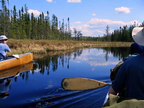
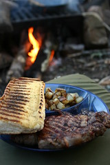 The distance turned out to be a bit longer than it looked, due to the meanderings of the rivers, but it was still worth it for the food. :-)
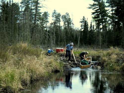
<td class="robCell"><div id="rob1"></div></td>


. . .


document.getElementById("rob1").innerHTML

= document.getElementById("flickr_badge_image1").innerHTML;
/* Rob Styles*/

.tumblr_photo

{

width: 125px;

height: auto;

float: right;

margin: 3px;

padding: 0px;

border: 3px #444444 solid;

}


.tumblr_posts

{

float: left;

margin: 0px;

padding: 0px;

margin-left: -10px;

}


.tumblr_post

{

font-size: x-small;

list-style-type: none;

width: 215px;

margin: 0px;

padding: 0px;

margin-top: 5px;

margin-bottom: 5px;

max-height:210px;

overflow: hidden;

border: thin black outset;

background-color: #222222;

old-background-color:#78a;

}

.tumblr_caption

{

padding: 2px;

margin: 2px;

}


 Alright, I'm long overdue for a post here. I thought I'd post something when I was all employed and settled in, but that's looking like it's going to take a bit longer than I'd originally thought. I'd been keeping up with posts in Flickr and Facebook, but nothing here. So here goes, more of a photo-dump than anything, I think I've also been put off by the sheer volume of stuff to write about.
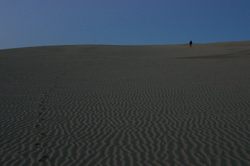
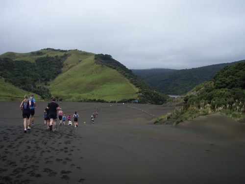
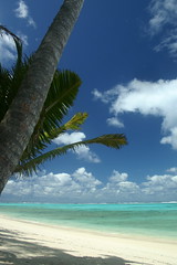
 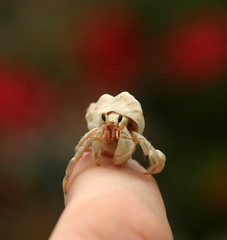 When I got bored, I'd harass the local wildlife or paddle around the lagoon in the house kayak. One morning I went for a run over the highlands in the center of the island on the cross island track. Unfortunately, I'd just missed the annual cross island race which was held the week before we arrived. It was a good 10-15k run, with about half dirt road and half muddy steep jungle track.
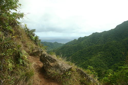
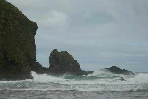
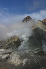 After Rarotonga, we headed over to Whakatane. Kel booked Claire and I on a trip out to White Island, an active volcano about an hour offshore by boat. Despite being seasick the whole way out, that was a great trip. Imagine Yellowstone without all the boardwalks and fences and warning signs. There are just random thermal features that pop up and fade away, and the crater lake changes colours dramatically, depending on what's going on below. When we were there, the water table was quite high due to recent rains, so there was steam everywhere, and new mudpots had recently opened. Our guide also said a second crater appeared to be forming. It had gone from the size of a plate to the size of a house in a matter of weeks. We couldn't go anywhere near that or the sulphur stacks due to the steam.
 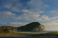 After Whakatane, we drove across through Gisbourne to Mahia on the East Coast, for a second attempt to go swimming with Moko the dolphin. He'd been hanging around Mahia for years, stealing people's beach toys and bringing them fish . . . until the week before we showed up. Now he seems to have moved up the coast to Gisbourne. That's unfortunate for Mahia, as in the off season (when the water's too cold for swimming) there's not a whole lot to do there. Also unfortunate is that it looks like Moko's been having more negative interactions with people in the more populated Gisbourne beaches, knocking surfers off their boards and harassing lifeguards . . . not good. They should maybe try to lure him back to Mahia for his own good.
 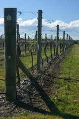 Next we continued along to Napier. Kel had booked us for a Wine Tour with a place called 'Grape Escape'. I should capture the names of the Wineries here before I forget them: Brookfields (excellent Pinot Noir), Ngatarawa/Farmgate, Elephant Hill (where Kel and I had the best gnocchi for lunch), and Matariki.

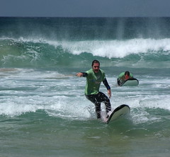 They'd gotten all the shopping out of the way, so we just hit some restaurants (in particular Bill Granger's place) and made a trip over to Bondi Beach. Kel and Claire relaxed in the sun while I went out on a surfing lesson. Those were the best waves I've had in a few attempts at surfing. Makes me wish I'd gotten out at Ohope a few times . . . one of those things you think you'll always have time to do. Then again, as fun as that was, I felt like I'd been hit by a train the next day. ;-)
 On the other side of the 20 hour trip, I took a cab to my parents place from the Minneapolis Airport after waiting an hour or so for my brother to pick me up. He'd dislocated his shoulder playing volleyball earlier in the evening, and was sitting in the waiting room of the hospital.


.tumblr_posts
  {
    margin: 0px;
    padding: 0px;
  }

.tumblr_photo
  {
    width: 110px;
    height: auto;
    float: right;
    margin: 7px;
    border: 2px black solid;
  }
  .tumblr_posts
  {
    margin: 0px;
    padding: 0px;
  }
  .tumblr_post
  {
    font-size: x-small;
    list-style-type: none;
    width: 210px;
    padding: 7px;
    margin: 5px;
    max-height:200px;
    overflow: hidden;
    border: thin black outset;
    background-color:#78a;
  }